grabowski
e4d5d274f0
grabowski
e4d5d274f0
Replace the network-wide (3.0, 4.5) m thresholds with per-station values
calibrated from the DB's discharge_percent (RID % of channel capacity):
warning = median level at 75-85% capacity, danger = median at 95-105%.
Fixes P.103 over-alerting (bank-full ~6.75 m, not 4.5) and P.67
under-alerting (overflow ~2.9 m). Requires a retrain to take effect in
the classifier heads.

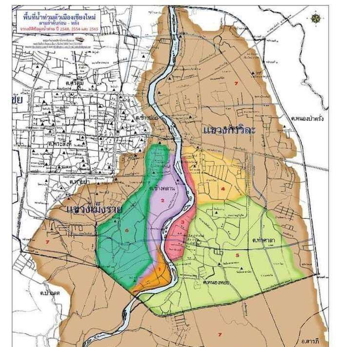
P.1 uses the official Chiang Mai municipal inundation map instead:
warning 3.70 m (stage 1, city flooding begins), danger 4.20 m (stage 5),
with the full 7-stage table (3.70-4.60 m + discharge) in
features.P1_FLOOD_STAGES. Forecast rows for P.1 now include per-stage
exceedance probabilities computed from the regression head + calibration
sigma - available immediately without retraining.

Dashboard: "Chiang Mai city flood outlook" block above the forecast grid
(predicted peak + 7 stage-probability chips) and a toggleable
georeferenced overlay of the official flood-zone map
(static/flood-zones-p1.jpg, bounds tunable in FLOOD_ZONE_BOUNDS).
147 KiB
697x710px
147 KiB
697x710px